


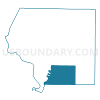
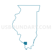
POMONA Voting District, Jackson County, Illinois
About
Outline

Summary
| Unique Area Identifier | 571242 |
| Name | POMONA Voting District |
| County | Jackson County |
| State | Illinois |
| Area (square miles) | 52.75 |
| Land Area (square miles) | 50.01 |
| Water Area (square miles) | 2.74 |
| % of Land Area | 94.80 |
| % of Water Area | 5.20 |
| Latitude of the Internal Point | 37.64149330 |
| Longtitude of the Internal Point | -89.35552090 |
Maps

Graphs
Select a template below for downloading or customizing gragh for POMONA Voting District, Jackson County, Illinois


Neighbors
Neighoring Voting District (by Name) Neighboring Voting District on the Map
- ALTO PASS Voting District, Union County, IL
- CARBONDALE 24 Voting District, Jackson County, IL
- COBDEN 2 Voting District, Union County, IL
- GRAND TOWER Voting District, Jackson County, IL
- MAKANDA 1 Voting District, Jackson County, IL
- MAKANDA 2 Voting District, Jackson County, IL
- MAKANDA 4 Voting District, Jackson County, IL
- MURPHYSBORO 10 Voting District, Jackson County, IL
- MURPHYSBORO 12 Voting District, Jackson County, IL
- SAND RIDGE 1 Voting District, Jackson County, IL
- UNION 1 Voting District, Union County, IL
Top 10 Neighboring County Subdivision (by Population) Neighboring County Subdivision on the Map
- Carbondale township, Jackson County, IL (29,544)
- Murphysboro township, Jackson County, IL (10,563)
- Makanda township, Jackson County, IL (4,353)
- Cobden District 2 precinct, Union County, IL (1,416)
- Union precinct, Union County, IL (983)
- Alto Pass precinct, Union County, IL (834)
- Sand Ridge township, Jackson County, IL (816)
- Pomona township, Jackson County, IL (802)
- Grand Tower township, Jackson County, IL (707)
Top 10 Neighboring Place (by Population) Neighboring Place on the Map
Top 10 Neighboring Elementary School District (by Population) Neighboring Elementary School District on the Map
Top 10 Neighboring Secondary School District (by Population) Neighboring Secondary School District on the Map
Top 10 Neighboring Unified School District (by Population) Neighboring Unified School District on the Map
- Murphysboro Community Unit School District 186, IL (15,612)
- Cobden School Unit District 17, IL (3,538)
- Shawnee Community Unit School District 84, IL (2,818)
Top 10 Neighboring State Legislative District Lower Chamber (by Population) Neighboring State Legislative District Lower Chamber on the Map
Top 10 Neighboring State Legislative District Upper Chamber (by Population) Neighboring State Legislative District Upper Chamber on the Map
Top 10 Neighboring 111th Congressional District (by Population) Neighboring 111th Congressional District on the Map
Top 10 Neighboring Census Tract (by Population) Neighboring Census Tract on the Map
- Census Tract 116, Jackson County, IL (3,912)
- Census Tract 103, Jackson County, IL (3,115)
- Census Tract 9502, Union County, IL (2,592)
Top 10 Neighboring 5-Digit ZIP Code Tabulation Area (by Population) Neighboring 5-Digit ZIP Code Tabulation Area on the Map
- 62966, IL (15,607)
- 62920, IL (3,265)
- 62903, IL (2,962)
- 62958, IL (2,262)
- 62942, IL (707)
- 62905, IL (677)
- 62998, IL (419)
- 62975, IL (279)